Google Earth
Recently I’ve found myself using Google Earth to see what various things look like from space. This can be quite intriguing, it is often interesting to see what certain walking paths look like from space, and things that are quite big from my grounded perspective often look much more insignificant from space.
For example, here is a picture of Telstra Tower taken from a Hot Air Balloon:

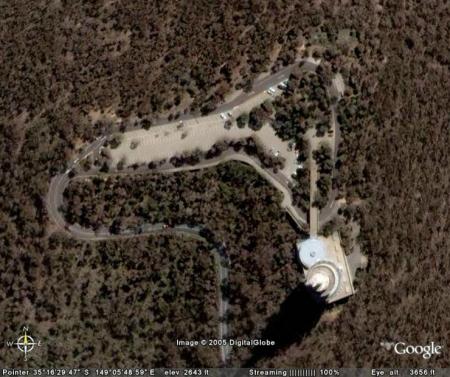
And here it is from space:

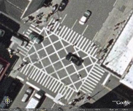
This is all quite fascinating, but it also has problems, I personally find it a bit disturbing that I am able to get a picture of a New York intersection like this:

That is about as far as I can zoom in before the picture becomes pixelated, and it is much closer than I can zoom in on cities outside of the US, in fact, here in Canberra, this picture of Dickson College is about as close as I can get without pixelation:

These pictures can be quite useful and interesting, but I think that, for the general public, satellite photos that can zoom in on an intersection with pretty good clarity are a bit over the top.
Samuel
23 comments September 20th, 2005 at 10:47pm